
Climate Change and Health Project – Strengthening Georeferenced Health Management Information Systems (Global Fund Supported)
This Project is implemented under the broader Climate Change and Health Project in Bangladesh, supported by the Global Fund. The overall project consists of multiple components delivered by different implementing partners. Within this structure, the work described here focuses specifically on the component titled “Strengthening Georeferenced Health Management Information Systems”, which aims to enhance the quality and usability of geospatial data for malaria surveillance and climate-sensitive health planning.
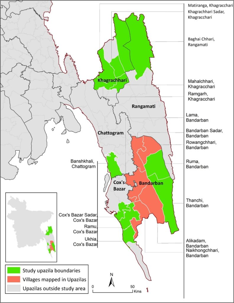
Under this component, technical services are provided to develop and operationalize a standardized village-level geospatial database for malaria-endemic and climate-vulnerable regions, particularly in the Chittagong Hill Tracts and adjacent endemic upazilas of Bangladesh. The work supports evidence-based targeting of interventions and strengthens spatial decision-making within national malaria elimination efforts.
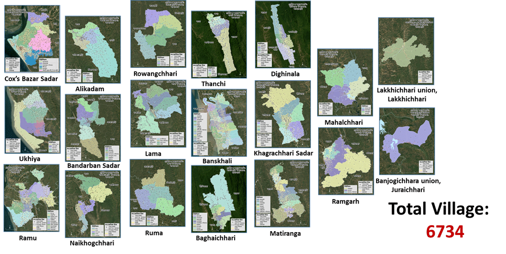
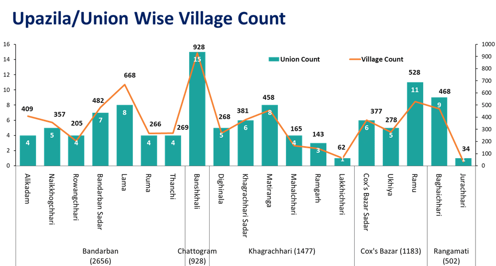
The implementation period spans June 2025 to June 2026, with ongoing activities contributing to the establishment and refinement of georeferenced health datasets. During the 2025 phase, a comprehensive village-level geospatial database was developed, covering 17 upazilas across endemic and hard-to-reach areas, with field data collected from 82 unions under 14 upazilas. In total, 6,734 villages were mapped, creating a robust spatial foundation for operational use in malaria planning and surveillance.
The component delivered a suite of standardized GIS outputs, including village centroid points, settlement boundary polygons, ward-level administrative boundaries, and updated union and upazila boundary datasets aligned with official administrative records. In addition, a structured village-level attribute database was developed, integrating key socio-demographic and environmental variables such as population characteristics, ethnicity, mobile network coverage, health facility access, and multi-hazard exposure.
Through this component, the project strengthens the integration of georeferenced health information systems within national malaria programming, enabling improved spatial surveillance, more precise targeting of interventions, and enhanced data-driven planning in climate-sensitive and malaria-endemic regions of Bangladesh.